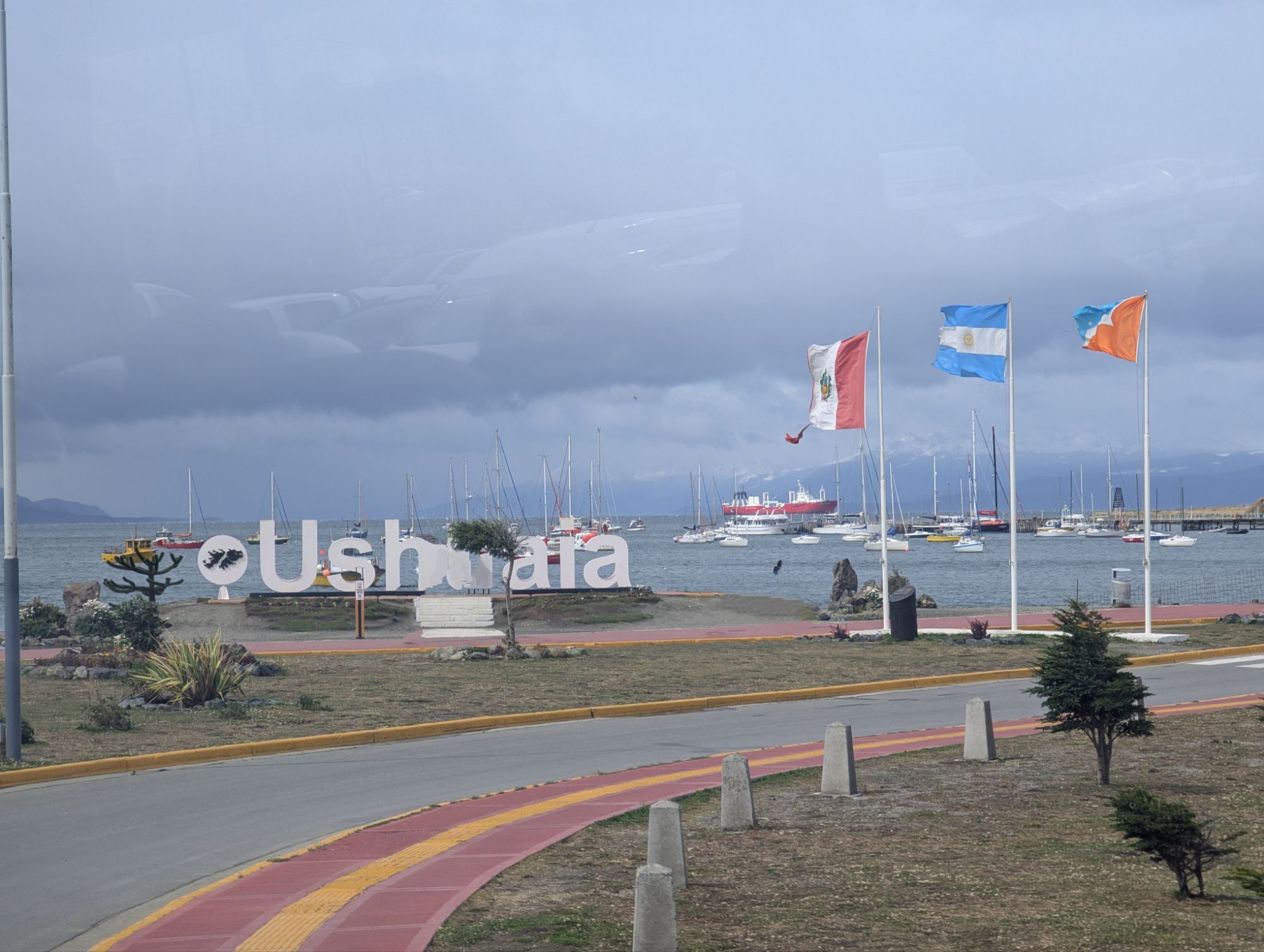
This morning we left early to fly to Ushuaia, the southernmost city in the world. It’s located below the 54th parallel south latitude on the main island of Tierra del Fuego, at the southern tip of South America.


In Spanish the name is pronounced “u-sua-ia” (the “h” is silent). The name Ushuaia comes from the language of the Yámanas, the native inhabitants. It means “the bay that penetrates westward.”
When we arrived in Ushuaia, we found weather that was completely different. It snowed here this morning, in summer! Their two seasons are “cold” and “not so cold”. Current temperature and the high for the day is 45º F.
Founded in 1884 and nicknamed “the end of the world,” Ushuaia has a population of 82,000, which is more than I expected. Today Ushuaia is a light industrial port and tourist destination. The windswept town, perched on a steep hill, is surrounded by the Martial Mountains and the Beagle Channel. The nearby Martial Glacier provides water to the city.

Due to its high southern latitude, roughly 680 miles from the Antarctic Peninsula, the city’s climate is influenced by Antarctica. The duration of daylight varies from more than 17 hours in summer to just over 7 hours in winter.
A penal colony modeled after one in Tasmania, Australia, was set up here in an effort to secure permanent residents from Argentina and to help establish Argentine sovereignty over all of Tierra del Fuego. The prison population thus became forced colonists and spent much of their time building the town with timber from the forest around the prison.
In 1896 the prison received its first inmates, mainly re-offenders and dangerous prisoners transferred from Buenos Aires, but also some political prisoners. It operated until 1947.
Leaving Ushuaia by car, you have to go through Chile. That means going through customs.
In the afternoon we sailed on a catamaran through Beagle Channel. It is the natural passage of the waters of the Pacific joining the Atlantic.

During the voyage they served us lunch.


Imperial cormorants look like penguins because of their black and white colors. They can dive into the water, reaching a depth of 30 yards.
Near Ushuaia we passed by Casco Island. Casco means helmet in Spanish. I couldn’t find the island on any map, but I saw it with my own eyes.


Back in the port we got the first sighting of our cruise ship, the National Geographic Endurance.


Leave a Reply