In 1980, when the country-formerly-known-as-Rhodesia finally achieved independence from Britain, it was ‘Great Stone Houses’ that inspired their brand new country name of Zimbabwe.
The word zimbabwe means “Great Stone House”. Zi= big or great; Mba= house; Bwe = stone
Similar cities with Great Stone houses were built all over the realm. They are all called ‘Zimbabwes’ and vary in size and significance.
The biggest and greatest zimbabwe is located in Masvingo, and they used no mortar.


The population of Zimbabwe is 16 million, and the capital is Harare. The capital city used to be Livingstone. There is 70% unemployment in Zimbabwe. We tried our best to help the local economy.
We bought some Black Serpentine Stone in Vic Falls from a local artisan named Bubble Gum. His said his real name was Tom.
Mining, agriculture (tobacco and maize), and tourism are the main economic drivers.
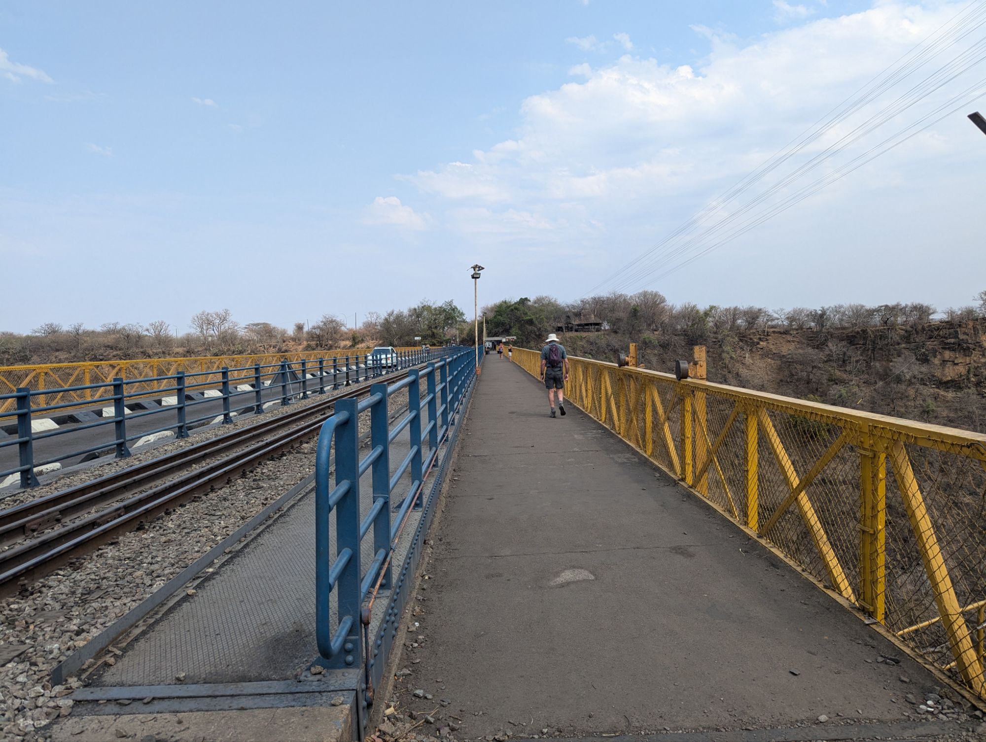
Zimbabwe was a British colony from 1890 to 1980. Cecil John Rhodes was involved in mining and built rail lines and constructed the bridge over the Zambesi River. Three countries made up Rhodesia, named after Rhodes.
Zimbabwe, originally called Southern Rhodesia, had to fight the British before 1980.
Zambia was originally named Northern Rhodesia. Independence came in 1964, and it was renamed Zambia after its longest river.
Malawi was part of Rhodesia and was originally named Nyasaland until 1965.
There are 32 languages that divide Zimbabwe geographically. 16 are official languages, including English.
Zimbabwe is aligned with British standards such as language, education, driving, and even tea time.
The “Scramble for Africa” was an effort to colonize Africa. The seven countries of Britain, France, Germany, Italy, Belgium, Spain, and Portugal met in Berlin in 1884-85 to divide up the continent.
Clicking q and x languages are from the original Bushmen and Bantu numbering about 100,000 to 120,000 They exist in the fringes and choose to live in primitive conditions.
Victoria Falls, in the Western part of Zimbabwe, is one of the seven natural wonders of the world.
Zimbabwe has one of the largest coal deposits in the world, and many trucks are hauling coal. Also, they mine for twelve different minerals.
Zimbabwe has eleven national parks covering five different biomes. These parks make up seven percent of the land. Teak trees do well in the sandy soil as do mopani and acacia trees.
There are a lot of British companies and many activities are performed administratively from other countries. A white minority was in control and occupied much of the good land and natural resources.
The local people were and are subsistence farmers. They were driven from fertile land. War resulted from 1968 to 1979. In 1979 a treaty was signed to end the fighting and grant the country independence.
The Great North Road that goes from Capetown to Cairo runs through Victoria Falls. The corresponding railroad didn’t make it all the way to Cairo but ended in Tanzania.
There was much discrimination with whites-only or members-only rules. Even though blacks were the majority, they were not treated as equals. For example, blacks and whites had to walk on opposite sides of the road.
Hyperinflation occurred in Zimbabwe during 2007 to 2009 due to failed economic policies and printing too much money. The peak inflation during the period is estimated at 79.6 billion percent month-on-month. That means if you had the equivalent of $1 billion in Zimbabwean currency one month, it would be worth the equivalent of one penny in U.S. currency the next month.
They stopped printing Zimbabwean currency in April, 2009, and instead started using foreign currencies. In 2019 they introduced a new Zimbabwean currency. In April, 2024 they introduced another new currency. The annual inflation rate, as high as 500% the past 5 years, is currently about 50%.
Today people do not put money in the bank and only want the stable US dollar. They use “pillow” banks (store money in their pillows). We did not see any current Zimbabwean currency and paid for everything in U.S. dollars.


Leave a Reply